What is GeoMundus?

GeoMundus is a free international symposium organised by the students from the Erasmus Mundus Master's of Science in Geospatial Technologies. The conference aims to share cutting-edge scientific research, knowledge, and skills in the fields of Geospatial Technologies, Geoinformatics, and Geosciences, including but not limited to geographic information systems and sciences, spatial cognition, geography, and spatial data sciences. This year’s GeoMundus will also explore the use of Artificial Intelligence in these fields, highlighting the research that pushes the boundaries of geospatial analysis through machine learning, with specific keynote, workshop, and presentations. Please see Programme Section for the more detail information.


Why GeoMundus?

GeoMundus is an opportunity to learn about and share scientific research, knowledge and skills with other students and researchers of all things ‘Geo’. This year, one of the topic of focus, ‘Artificial Intelligence in Geoinformatics’ will give participants the chance to learn about technological advancements of AI, research activities on it and it’s applications on geospatial technologies in today’s world. GeoMundus is unique, featuring workshops where participants can experience first-hand the future of the field as well as a career session specially designed for students interested in a geospatial career.

Who should participate in GeoMundus 2018?

Everyone who is curious about geospatial technologies and their applications. We especially welcome students, researchers, industry leaders, and interested members of the public. It is not only a great opportunity to learn, but also to network with the brightest minds in this exciting field.

2018 Conference photos

SPEAKERS

We are excited to have five keynotes speakers sharing their expertise at our conference. Please visit their personal websites to find out more about them.

Michael Frank Goodchild

Michael F. Goodchild is Emeritus Professor of Geography at the University of California, Santa Barbara, where he also holds the title of Research Professor.
He is also Distinguished Chair Professor at the Hong Kong Polytechnic University and Research Professor at Arizona State University, and holds many other affiliate, adjunct, and honorary positions at universities around the world.
Until his retirement in June 2012 he was Jack and Laura Dangermond Professor of Geography, and Director of UCSB’s Center for Spatial Studies. He received his BA degree from Cambridge University in Physics in 1965 and his PhD in geography from McMaster University in 1969, and has received five honorary doctorates.
He was elected member of the National Academy of Sciences and Foreign Member of the Royal Society of Canada in 2002, member of the American Academy of Arts and Sciences in 2006, and Foreign Member of the Royal Society and Corresponding Fellow of the British Academy in 2010; and in 2007 he received the Prix Vautrin Lud.
He was editor of Geographical Analysis between 1987 and 1990 and editor of the Methods, Models, and Geographic Information Sciences section of they Annals of the Association of American Geographers from 2000 to 2006.
He serves on the editorial boards of ten other journals and book series, and has published over 15 books and 500 articles. He was Chair of the National Research Council’s Mapping Science Committee from 1997 to 1999, and of the Advisory Committee on Social, Behavioral, and Economic Sciences of the National Science Foundation from 2008 to 2010. His research interests center on geographic information science, spatial analysis, and uncertainty in geographic data.
We are delighted to have Dr. Goodchild to share his long experience on GIScience and tell us about the future directions of the field!


Monica Wachowicz

Monica Wachowicz is Full Professor in Data Science, and the Cisco Innovation Chair in Big Data and the NSERC/Cisco Industrial Research Chair in Mobility Analytics at the University of New Brunswick, Canada.
She is also the Director of the People in Motion Laboratory, a centre of expertise in the application of Internet of Things (IoT) to digital cities. Her research interests include fog/edge computing, machine learning on graphs, mobility analytics, and IoT applications.
She works at the intersection of
  1. Streaming Analytics for analyzing massive IoT data streams in search of understanding mobility behaviour in digital cities; and
  2. Cartography for designing maps for a world in which ‘intelligence’ will be embedded in virtually everything around us.
She is a founding member of the Technical Committee on Big Data (TCBD) of the IEEE Communications Society and the International Journal of Big Data Intelligence. Her pioneering work in multidisciplinary teams from government, industry and research organizations is fostering the next generation of data scientists for innovation.

Miguel de Castro Neto

Miguel de Castro Neto is Assistant Professor and the Associate Dean at NOVA Information Management School.
His research and teaching interests lie in the field of Business Intelligence and Smart Cities.
He won the ”Smart Cities Personality of the Year” award from Green Business Week in 2017.
He is the president of Pedagogical Council and Coordinator of the Post-Graduation in Smart Cities.
He is also the president of the Portuguese Engineers Professional Association Agronomy College and working as a coordinator of the Group Cities and Spatial Planning committee in the think tank Sustainable Growth Platform. He is founder and vice-president of the Data Science Portuguese Association.
He is also founding-partner of the company Agriciência, Consultores de Engenharia, Lda. We are excited to have him at our conference for his expertise in the burgeoning geographic field of smart cities.


Francisco Pinto Espinosa

Francisco Pinto Espinosa is an Associate Scientist at the International Maize and Wheat Improvement Center (CIMMYT) global wheat program.
CIMMYT works to improve livelihoods and foster more productive, sustainable maize and wheat farming.
Pinto’s work focuses on remote sensing imagery and UAV for data acquisition.
He obtained a PhD in agriculture from the University of Bonn and the Jülich Research Center in 2015.
His research interests include the use of remote sensing for field phenotyping and understanding ecophysiological dynamics of crops at different spatio-temporal scales and the development of high-throughput phenotyping approaches for improving genetic gain and for quantifying physiological traits.
He is also interested in the use and validation of sun-induced chlorophyll fluorescence for crop canopies.
We are excited to have him to teach us about the application of remote sensing in the field of agriculture!


Bruno Martins

Bruno Martins is an assistant professor at the Computer Science and Engineering Department of Instituto Superior Técnico (IST) in the University of Lisbon and a researcher at the Information and Decision Support Systems Lab of INESC-ID, where he works on problems related to the general areas of information retrieval, text mining, and the geographical information sciences.
He has been involved in several research projects related to geospatial aspects in information access and retrieval. Especially he has accumulated a significant expertise in addressing challenges at the intersection of information retrieval and the geographical information sciences (i.e. an area that is often referred to as geographical information retrieval).
We are extremely glad to have him to get insight about AI and learn about the challenges with the unstructured data.


Universidade Nova de Lisboa

Nova - Information Management School

NOVA Information Management School is the School of Statistics and Information Management of Universidade NOVA de Lisboa. It was founded in 1989 in response to a large number of graduates who specialized in Information Management and the growing need for the use of new information technologies. Located in the beautiful Campolide campus, NOVA IMS has an infrastructure equipped with the most modern information and teaching support technologies. Today, NOVA IMS provides high level education to more than 1000 students, from over 60 countries. The offer includes two bachelor degrees, six master degrees, including an Erasmus Mundus Master Course and a double degree European Master Course, a doctorate and several postgraduate courses.


How to get to Nova IMS: Closest Metro Stations: Buses with stops closest to NOVA IMS:

Programme

Please check our website frequently for the latest updates and follow us on our social networks to receive the latest news and announcements.

  • Time Description
    19:00 + Introductory tour around the historical centre of Lisbon

    We cordially invite all the participants of GeoMundus 2018 to a tour around the astonishing Lisbon city center. Be ready to meet amazing people, share a drink and get into GeoMundus conference mood. The details are as follows:
    When: Thursday 6th December 2018, 19:00
    Where: Praça do Comércio

    (Note): This is an informal session. Cost of drinks or snacks should be self-payed.

  • Time Description
    8:00 Registration (with coffee)
    9:00 Opening Ceremony
    9:15 + Keynote Presentation 1: Michael Goodchild

    Title: Future directions in GIScience

    The technical environment for GIScience is changing rapidly, with growing interest in such topics as social media, autonomous vehicles, Big Data and data science, artificial intelligence and deep learning, and urban informatics and smart cities, all of which have significant geospatial dimensions. There is also growing tension between ease-of-use on the one hand, and rigorous science on the other. I sketch some key issues that will determine how GIScience can and should develop in this increasingly challenging environment.

    10:00 + Short documentary about Geomundus history


    This year, Geomundus marks the 10th iteration of the conference. We would like to present you the visual presentation on how it got started 10 years ago and what has been its impact among the organizing students and participants.

    10:15 + Keynote Presentation 2: Miguel de Castro Neto

    Title: Urban Intelligence Building Blocks

    A smart city is seen nowadays as a urban space that takes advantage of information and communication technologies and data science to answer todays challenges, namely to become more efficient in services and infrastructures management and also to deliver increased quality of life to the people who lives, works or visits the city, not forgetting the support to fight climate change. In this presentation we will cover the ongoing cities digital transformation process and propose a concept of urban intelligence and its building blocks that is inducing a paradigm shift leading to a vision of the city as a platform where urban planning and management is supported by urban analytics and real time data.

    11:00 Coffee break
    11:30 + Presentation Session 1: Mr. Akhil Jayant Patil, University of Münster

    Title: Forecasting disease spread to reduce crop losses [Crop Disease Spread Detection-CDSD]

    11:45 + Sponsor Presentation: Mr. Mamede Barreiros, HERE

    Title: HERE Open LocationPlatform - Discover the most Critical Data Asset for Your Business

    The platform for Location intelligence - a comprehensive platform that solves the problem of fragmented and disparate data sources in a collaborative environment, enabling business to monetize their most valuable asset: data

    12:00 + Presentation Session 2

    1. Daria Luedtke, Lisa Fischell, Moses Duguru, Title: Capabilities of SAR and optical data for rapid mapping of flooding events
    2. Somnath Chaudari, Title: Potential of Geospatial Mashups in Promoting Tourism Resources: A Case case-study
    3. Amrit Karmacharya, Title: Utility of a sensor fusion of GPS and motion sensor in android devices in GPS deprived regions

    12:45 Lunch
    14:45 + Keynote Presentation 3: Dr. Bruno Martins

    Title: Mining Geospatial Information from Unstructured Data

    Vast amounts of geographically-related multimedia data contents are nowadays available online and/or in digital formats, which has created new opportunities related to the application of spatial analysis methods within fields such as the computational social sciences and/or the digital humanities (e.g., using unstructured big data to understand how people observe their world). Examples include Wikipedia or news articles, travel diaries or blog entries, Twitter messages, or online photographs. These multimedia contents about places, crowdsourced from social sensors or available within large collections, are often of high value because they offer alternative views on places, more complete and/or up-to-date than other authoritative geospatial data sources. However, there are also several challenges in using this information, related to its unstructured and un-standardized nature (e.g., it is difficult to correctly match information in texts and/or photos to specific locations on the Earth). This talk will review the use of machine learning approaches for extracting geographical information from unstructured contents, discussing recent approaches based on deep neural networks for classifying and/or geo-referencing unstructured data, of interest to several application domains.

    15:30 + Presentation Session 3: Mr. Daniel Nyangweso, Department of Cartography and Geo-informatics, Eőtvős Lorand University, Budapest

    Title: Characterizing lineage of geographical names using public and geoparsed volunteered geographic information within a digital gazetteer service in Kenya

    15:45 + Poster Session and Coffee break

    1. Faus Tinus Handi Feryandi, University of Bonn
        Title: UAV fixed-wing orthophotos for cadastre in Indonesia’s coastline areas: accuracy assessment
    2. Alexandre Baptista, Nova IMS
        Title: giCASES: Case based learning in the field of Geographical Information
    3. Bilgesu Kivrak, Tiago H. Moreira de Oliveira and Marco Painho, Nova IMS
        Title: 10 Years Of Master Of Science In Geospatial Technolgies: Development of a Web App with GeoTech Students Data

    16:45 + Career Development Session

    An interactive panel discussion providing a great opportunity for students interested professionally in geospatial technologies.
    Attendees will get to ask our distinguished panelists questions like:
    1. What are the possibilities and options for building your career in geoinformatics?
    2. Should one pursue further studies (PhD), or go into the workforce after the master degree?
    3. What are the critical ideas for geospatial entrepreneurs?
    4. How can we influence society through GI knowledge? What are the challenges in such project?
    5. What tips do you have for advancing a GI career?

    Panellists include our keynote speakers, professionals, and academic leaders.

    17:45 Closing First Day
    20:00 + The Conference Dinner

    A fabulous opportunity for socializing and continuing discussion that started during the day. This year's delicious meal will take place at Pano de Boca Restaurante.
    Address: R. Ramalho Ortigão, 1070-238 Lisboa
    Latitude: 38°44'09.9"N
    Longitude: 9°09'31.7"W
    About: A cozy restaurant with a great selection of Portuguese cuisine presented in a modern and creative way, located 600 meters away from the conference venue. Website: http://www.panodeboca.pt
    Unfortunately, due to budget and space constraints, only the first one hundred participants to have registered will be invited. Look for the invitation in your program when you arrive at the conference.

  • Time Description
    9:00 Registration (with coffee)
    9:30 Opening & keynote introduction
    9:35 
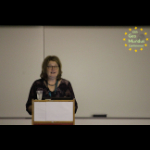
+ Keynote Presentation 4: Dr. Monica Wachowicz

    Title: What’s next? Analytics Everywhere Ecosystems

    The Internet of Things (IoT) is transforming public infrastructure into digital things that can enhance the quality of life of citizens. But the unquestionable change for digital transformation in our cities may come from citizens themselves. The Internet of Things generate an unprecedented amount of data streams about citizen experience that is impossible to handle using traditional GIS. Mainly because the data streams usually exhibit high data rates with out-of-order arrival problems, communication loss, and they are usually noisy, incomplete, and unreliable. The research challenges are related to how we can analyze these data streams in a timely way considering computing power, storage capability, network communication, privacy, security, and energy limitations of IoT environments. In this presentation we will explore how analytics everywhere ecosystems are modernizing analytical workflows in order to allow data scientists to collect and analyze data streams as they are being transported through distributed resources such as edge, fog and cloud computing. These ecosystems will deliver new insights for improving a citizen’s ability to understand what is happening and take an action accordingly.

    10:20 + Presentation Session 4: Mr Pramit Ghosh, University of Münster

    Title: Running user-defined functions in R on Earth observation data in cloud back-ends

    10:35 Coffee Break
    11:05 + Presentation Session 5

    1. Braundt Lau, Title: Route optimization with ArcGIS on waste management in Hong Kong
    2. Berhanu Berga, Title: Spatial distribution of malaria indicators in Ethiopia in 2009-2013
    3. Mr Mutaz Qafisheh, Title: Water harvesting estimation using GIS in Bani Na'im
    4. Dennis Irorere (Representative: Adeoluwa Akande), Title: Strengthening Vaccination Delivery with GIS in Northern Nigeria

    12:05 + Experience Sharing: Ms Sarah Abdelkader, Alumna of Master of Science in Geosptaial Technologies, Currently working for HERE Technologies, Egypt

    Title: My journey from here to HERE

    12:15 Overview of Workshop Session
    12:30 Lunch
    14:00 + Keynote Presentation 5: Francisco Pinto

    Title: Using remote sensing for improving crops and ensure food security: the experience of CIMMYT

    The International Maize and Wheat Improvement Center (CIMMYT) is an important player in the task of facing the challenges that changes in the world’s demography, environment and climate, are posing to agriculture nowadays. Through the breeding of better-adapted wheat and maize varieties, the ultimate goal of CIMMYT is to improve livelihood and to ensure food security, especially in developing countries. A key component of the breeding process is plant phenotyping. The evaluation of relevant plant traits is essential not only to ensure higher yields, but also to design strategies that could result in plants adapted to different environments around the globe. The incorporation of remote sensing (RS) tools for plant phenotyping has boosted our capacity to evaluate large populations of germplasm for relevant and complex traits, facilitating the application of phenomics at different stages of the breeding process and helping to understand the genetic basis of the interaction between gene and environment. The fast development of unmanned aerial vehicles (UAVs) has represented an excellent opportunity for plant phenotyping. These platforms have been implemented in CIMMYT for more than five years, and they have demonstrated to be effective and affordable to remotely measure traits such as canopy temperature and NDVI in thousands of wheat and maize lines. While the canopy temperature is a good predictor of yield and root function under abiotic stress, the spectral indices such as NDVI can be used for predicting traits such as yield and biomass. In this presentation, we show our latest advances in the analysis of UAV based imaging for the screening of genetic resources within the context of breeding and physiological pre-breeding. We also discuss possible upcoming innovations that are currently in the pipeline. Finally, we discuss the potential of this technology to improve the output of national breeding programs and farmers in developing countries.

    14:45 + Concurrent Workshops

    This session includes 5 concurrent workshops. The aim is to provide participants with practical, hands-on exercises and activities.

    Workshop 1: Urban Ecosystem Services with GIS.
    Facilitator: Pedro Cabral, Assistant Professor at NOVA Information Management School
    The sustainable use of natural resources is of utmost importance for mankind. In this workshop we will introduce the concept of urban Ecosystem Services (ES). Then, we will explain how urban ES can be valued, both in biophysical and monetary terms. We will refer to some tools to work with ES biophysical and economic valuations focusing on InVEST tool from Natural Capital Project. We will use a case-study to demonstrate this approach. The objective is to show how we can use Geographic Information Systems (GIS) and natural capital information for sustainable urban planning. At the end of this workshop, you should be able to:
    i. Understand and explain what urban ecosystem services are.
    ii. Understand how we can measure and value urban ecosystem services.
    iii. Use GIS and InVEST tools for quantifying ecosystem services.
    iv. Understand how to integrate natural capital information into urban planning.

    Workshop 2: Smart Cities and Blockchain Technology
    Facilitator: Miguel de Castro Neto, Assistant Professor and the Associate Dean at NOVA Information Management School and
    Henrique Carreiro, Invited Assistant Professor at NOVA Information Management School.
    With a global trend of growing urban population and faced with the need of fighting climate change cities are taking advantage of the ongoing digital transformation to be more efficient in resources usage and at the same time optimize services and infrastructures management in order to provide better services and guarantee higher quality of life to the people that lives, works and visits the cities. This new reality, often referred as Smart Cities, is taking advantage of the Internet of Things, Big Data, Data Science, Artificial Intelligence and many more possibilities induced by the digital transformation of urban spaces and by the city as a platform approach to create more sustainable and resilient cities. Having said that, blockchain is being seen as a disruptive technology that also in the context of smart cities will have a significant impact, either in the present business models and in new products and services that are yet to be created. In this workshop we will present blockchain, a peer-to-peer distributed ledger that is cryptographically secure, append-only, immutable, and updatable only via consensus or agreement among peers, how it works and how it is already impacting the smart city with the presentation of the major trends and potential applications.

    Workshop 3: HERE Map Creator & Developer Portal
    Facilitator: Pedro Conceição, Community Lead at HERE Technologies
    In the first part of this workshop HERE will introduce their web-based map editing tool HERE Map Creator, where you can edit your own real-life experience of your surroundings directly into HERE Maps. You can add or update roads, routes, places and house numbers to bring accuracy and context to the digital world. Participants will be guided on how to use the Map Creator to generate content on HERE Maps. It will be also touched the partnership with Mapillary a platform to upload photos they have of a point of interest to contribute to a global database of street views of cities.

    Facilitator: Juanma Anera, GIS Data Engineer II at HERE Technologies Sevilla
    In the second part, participants will be introduced to HERE Developer Portal and to our APIs and SDKs for maps and location-aware web and mobile apps. Also it will be touched the HERE Freemium, a plan where you'll have everything you need to build location-aware applications. Our expansive range of APIs and SDKs are intuitive and reliable, with high transaction thresholds.

    Workshop 4: Real Life Use of Geospatial Technologies in Humanitarian Responses
    Facilitator: Spee Braun, consultant for Save the Children and other international humanitarian organizations
    The scale and human impact of humanitarian crises in the world has reached unprecedented levels.The global capacity to respond, while growing, remains challenged to meet the needs. To more effectively protect and save lives, humanitarian organizations need accurate, timely, and easily visualized geographic information. This workshop will explore how GI is contributing - and can contribute further - to expanding the global capacity to carry out humanitarian response in accordance with global standards and in real life circumstances, carrying out the work in low-resource, rapidly changing, and/or insecure environments. By the end of the workshop, you will:
    - Know about the primary uses of geospatial technologies in humanitarian responses
    - Have heard stories about practical challenges and explored how these might be overcome
    - Considered future possibilities for use of geospatial technologies in support of humanitarian responses

    Workshop 5: Open Source Geospatial Technologies: What, Why, and How
    Facilitator: Alaa Abdelfattah and Lucas Braun (second year students of the Master in Geospatial Technologies)
    This workshop provides an opportunity to learn about open source geospatial tools that are popular today. The content is informed by our course work in the Master of Geospatial Technologies.
    By the end of the workshop, participants will:
    i. Know the definition of open source and have considered its pros and cons in GI.
    ii. Know about some of the open source geospatial tools exist today, and where to find more information about them.
    iii. Have personal experience developing (hands-on) with one or more open source geospatial technologies.
    iv. Know about how to contribute to open source software.
    v. Have considered the future of open source geospatial tools.

    17:00 Closing Ceremony of the Conference

Call for Short Papers and Posters

The submission period for short papers is now closed.
The submission period for posters is now closed.

Thank you for your interest in participating in GeoMundus 2018. All individuals interested in any aspect of geospatial technologies are invited to submit their research, and we will let you know if we have space for your poster at the conference. Please follow the poster guidelines when submitting.

Please note that GeoMundus does not provide invitations and does not support Visa Processes.

During the submission process, you will be asked to identify the most applicable topic for your poster. Potential topics along with applications of Geospatial Technologies and its Interaction include, but are not limited to:

  • Cadastre
  • Cartography
  • Environmental Management
  • Geodesy
  • Geographic Information Science
  • Geography
  • Geoinformatics
  • Geospatial Databases
  • Geospatial Data Mining
  • Geostatistics
  • Landscape Ecology
  • Location Based Services
  • Navigation
  • Remote Sensing
  • Spatial Cognition
  • Spatial Data Science
  • Surveying
  • Others

We would also like to invite posters about Artificial Intelligence in Geoinformatics, the sub-theme of our conference.
These include:

  • Big Data
  • Cloud Computing
  • Data Analytics
  • Data Visualisation
  • Machine Learning
  • Deep Learning
  • Unmanned Aerial Systems/LIDAR
  • Satellite imageries
  • Cognitive Science
  • User Adaptivity
  • Others
A confirmation email of receipt will be sent to you after successfully completing the submission form. Please keep a copy of this confirmation for your records.

We will notify the authors of accepted short papers on September 24th, 2018.
We will notify the authors of accepted posters on November 18th, 2018.
We will publish the accepted short papers and posters on the GeoMundus website.

For any questions about templates, formatting and submission, please write an email to program@geomundus.org

Participant Registration

The registration period is now closed.


Submissions of Short papers and Posters

The submission period for short papers is now closed.
The submission period for posters is now closed.

The scholarships (3 grants, 500 Euros each) were provided by AGILE to the best short paper submission to the following students:

Congratulations!

2018 Team

GeoMundus is a symposium organised and facilitated by the students of the Erasmus Mundus Master's of Science in Geospatial Technologies.

BUDGET TEAM

Duarte Nunes Duarte Nunes
Linkedin

Fabián PerottiFabián Perotti
Linkedin

Kushal SharmaKushal Sharma
Linkedin

LOCAL ORGANISATION TEAM

Manvel KhudinyanManvel Khudinyan
Linkedin

Jonas MeyerJonas Meyer

Mitzi Vidal Mitzi Vidal

Renan Barroso Renan Barroso
Linkedin

Roberto Luna Roberto Luna

PROGRAMME TEAM

Eliza ShresthaEliza Shrestha

Fana Gebremeskel Fana Gebremeskel

Laxmi Thapa Laxmi Thapa
Linkedin

Matheus S. Barros Matheus S. Barros

Nicholas AsangaNicholas Asanga
Linkedin

Tamene GelayeTamene Gelaye
Linkedin

PUBLIC RELATIONS TEAM

Denny Palinggi Denny Palinggi
Linkedin

Manuel Mendoza Manuel Mendoza
Linkedin

Sadegh KarampanahSadegh Karampanah
Linkedin

Stefana CiobanStefana Cioban
Linkedin

Vanesa Perez SanchoVanesa Perez Sancho

STEERING TEAM

Brhane BahrishumBrhane Bahrishum
Linkedin

Lorena AbadLorena Abad
Linkedin

Lucas BraunLucas Braun
Linkedin

Luuk van der MeerLuuk van der Meer

Nicodemus NyamariNicodemus Nyamari

WEB TEAM

Alaa Bakry AbdelfattahAlaa Bakry Abdelfattah
Linkedin

Ang Dawa SherpaAng Dawa Sherpa
Linkedin

Daniel Marsh-HunnDaniel Marsh-Hunn

William MartinezWilliam Martinez
Linkedin

Contact

If you have any questions, please contact us via email. Alternatively, please write to us at our mailing address listed below.

Mailing address

Nova Information Management School
Universidade Nova de Lisboa
Campus de Campolide
1070-312 Lisboa | Portugal

Sponsors & Partners

We would like to thank our sponsors and partners for their generosity and help making this event a huge success.

Should you wish to sponsor the 2018 GeoMundus conference, please contact the budget team at budget@geomundus.org

Partners


Sponsors